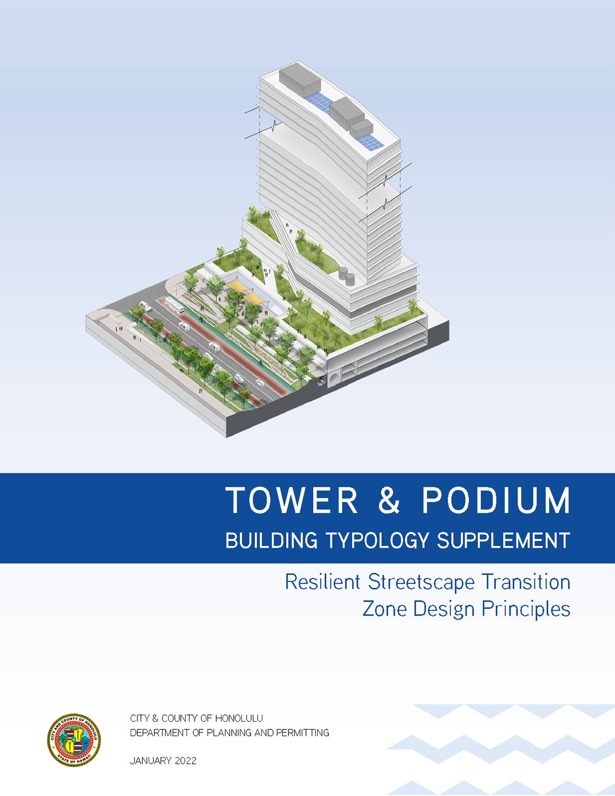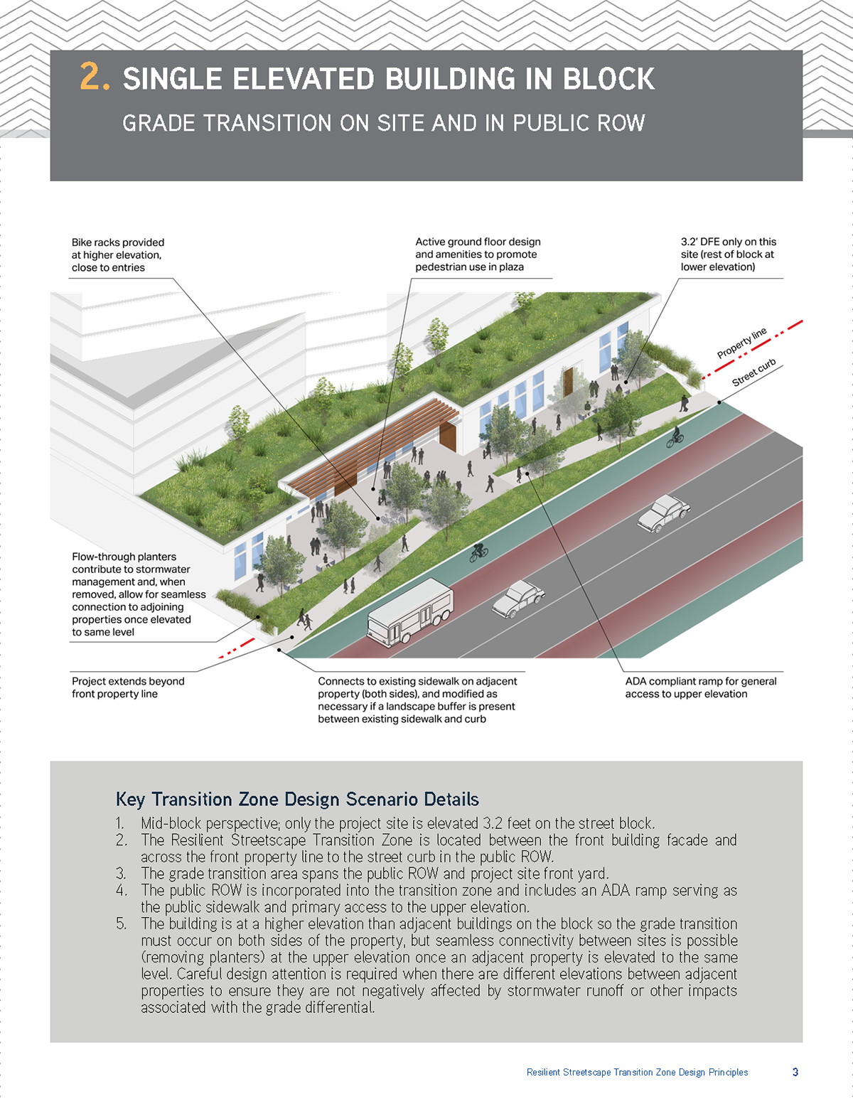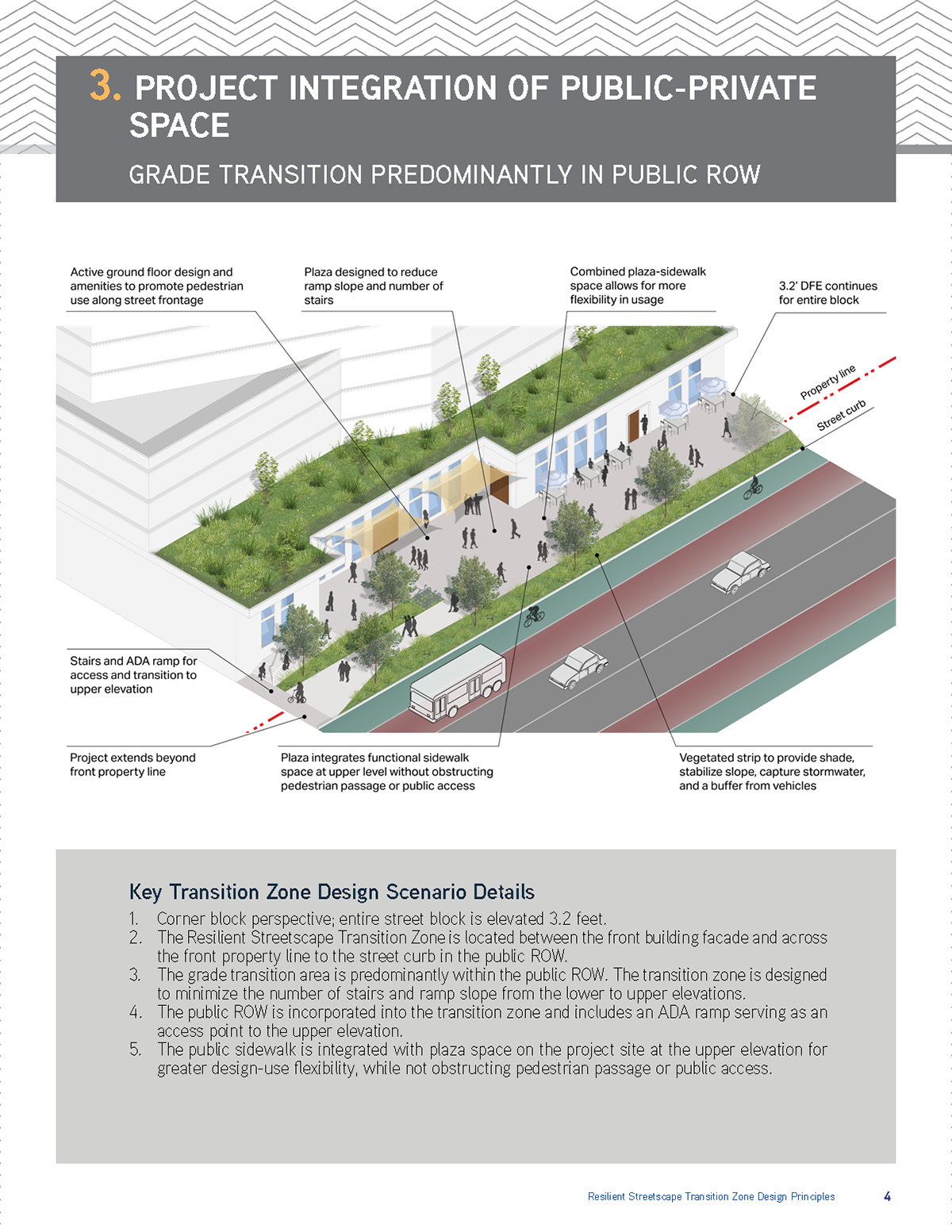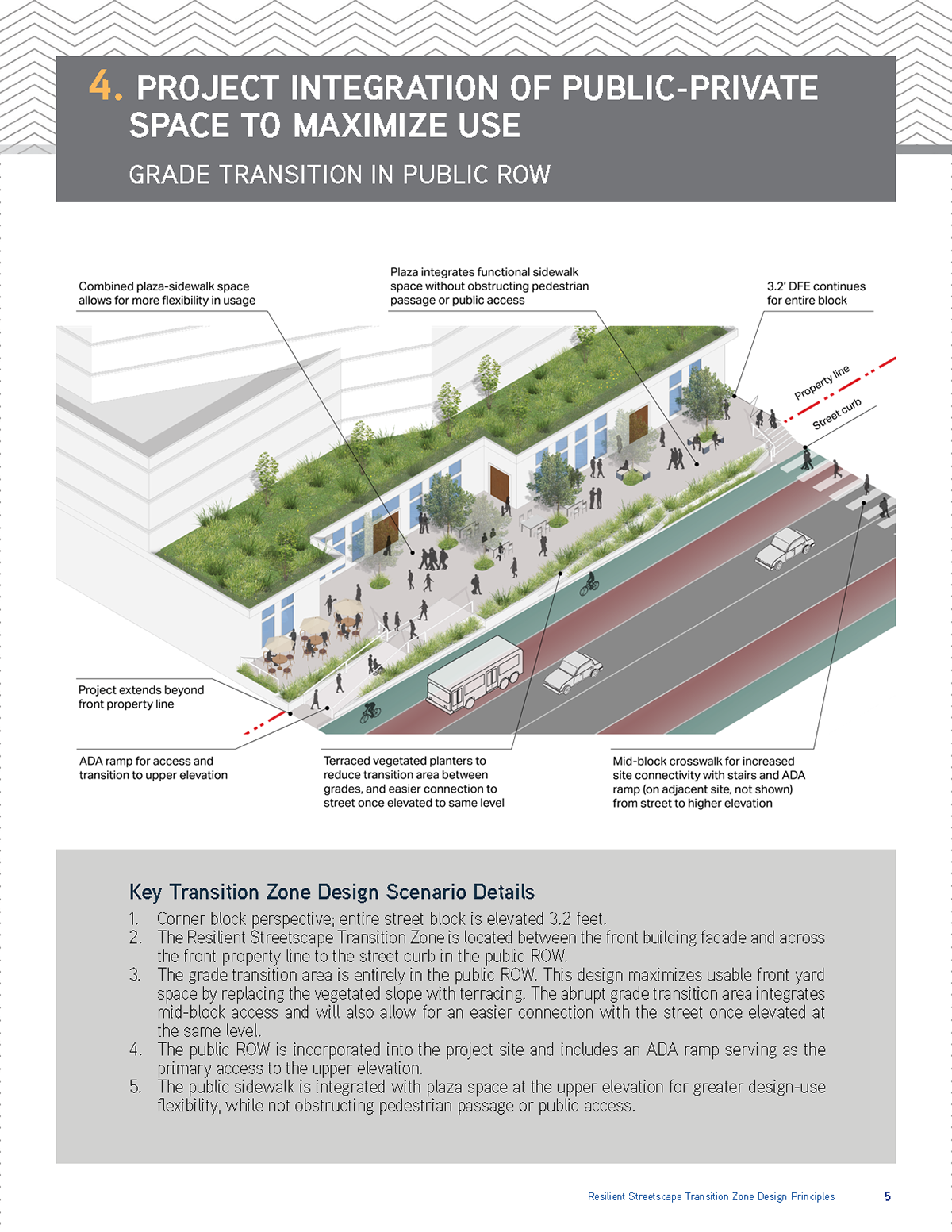

During my employment at the City and County of Honolulu, I undertook a range of graphic design responsibilities. My initial assignment involved expanding upon the city's climate adaptation design principles for urban development. This comprehensive guide, developed by SSFM, encompasses crucial information related to enhancing the urban center's resilience against extreme heat and increased flooding events. It also delves into the best practices regarding elevated design flood elevations for buildings.
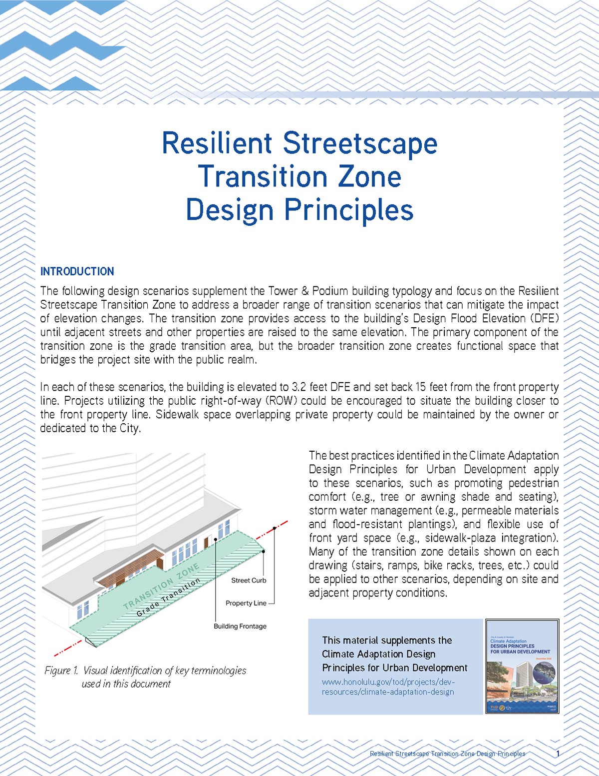
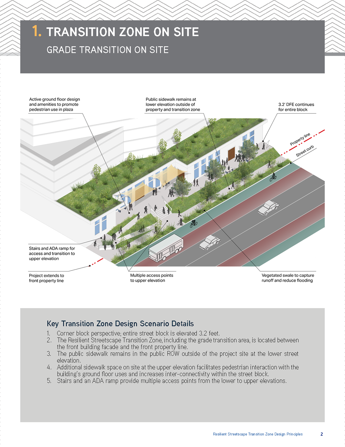
My primary role in this project was to create diverse scenarios for the resilient streetscape transition zone. This transition zone is the difference in elevation between the ground floor of the building and the streetscape level. These scenarios were required to align with setback regulations and accommodate a grade change of 3.2 feet. After engaging in several collaborative meetings, we selected four scenarios. I ensured that the developed designs maintained the same aesthetic as the climate adaptation design principles, as this guide serves as a supplementary resource. The design, graphics, and textual content, were completed by myself with editorial input from Senior Lead Planner, Tim Streitz.
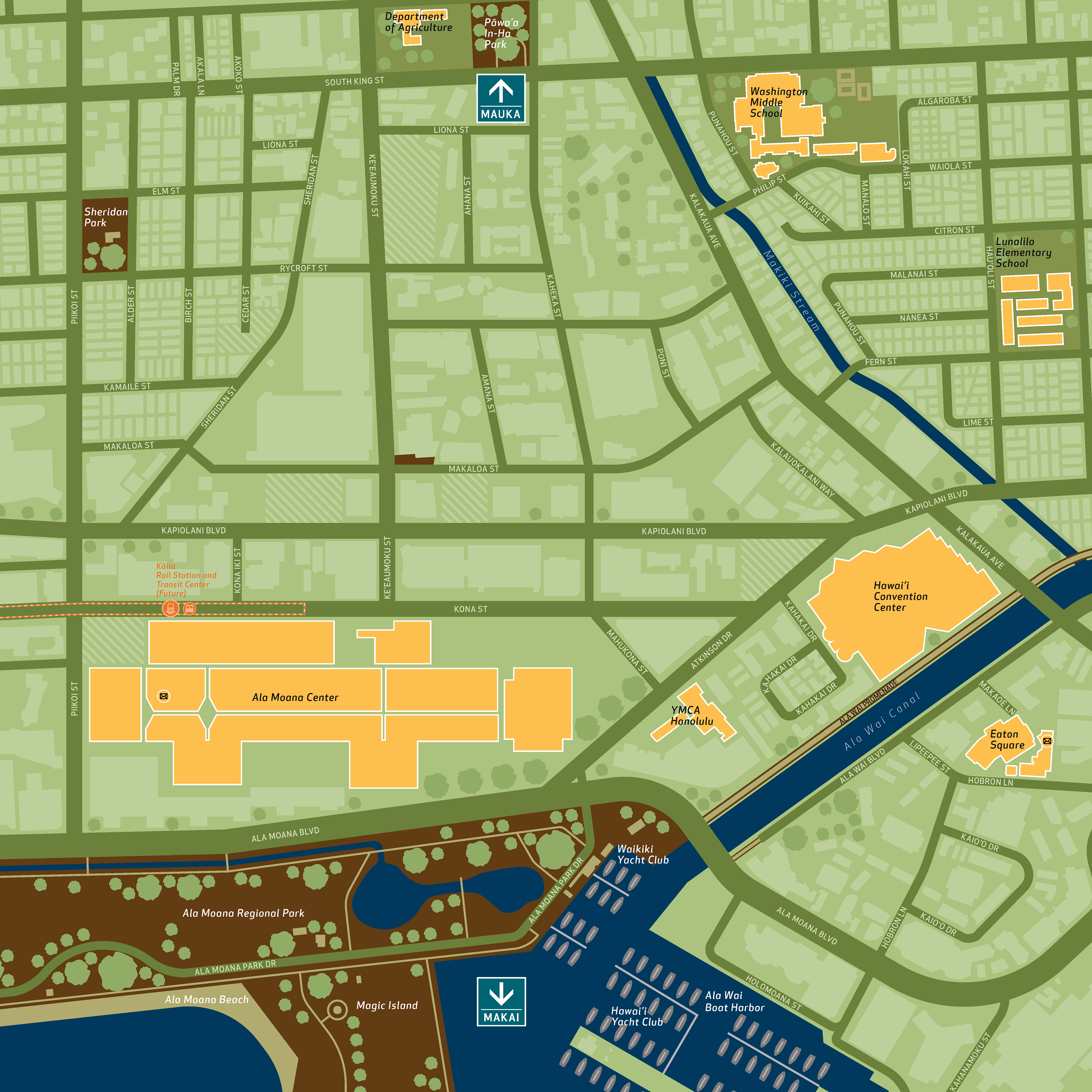
Another noteworthy project I successfully executed was the creation of a pedestrian wayfinding map for the Kālia (Ala Moana) rail station. This map serves as a valuable resource for pedestrians and commuters, aiding them in navigating the Transit-Oriented Development (TOD) region. It adheres to the visual style established by TwoTwelve, the consultants responsible for crafting wayfinding maps for the rail stations situated on the northern section of the rail line. The completed map will be printed and prominently displayed throughout the station premises.